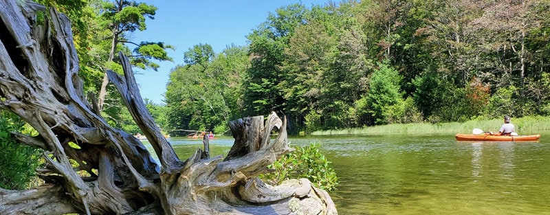
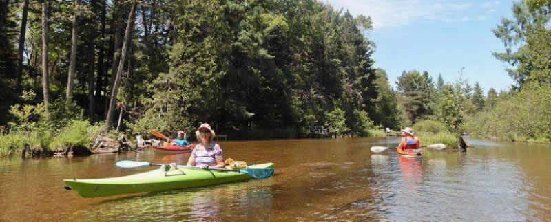
Michigan has an abundance of water, ranging from lakes, rivers with rapids of various difficulty, scenic water trails, and nature at its finest.
You are never far from a paddling spot in Michigan.
Choosing where to go might be overwhelming, so here is a list of the best places to kayak in Michigan.
Contents
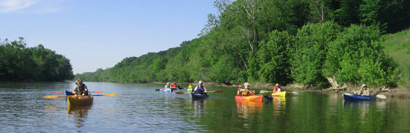
Au Sable River
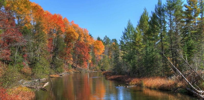
The Au Sable River lies in the Northern Lower Peninsula of Michigan. Its source is at Grayling’s north, MI, and flows for over 100 miles, draining into Lake Huron in the little AU sable community.
Au Sable River is well renowned for trout fishing. But, if kayak fishing is not your thing, you may be interested in the wide range of wildlife you can spot along the river.
It’s ideal for both day and night trips and features multiple campgrounds along its shores. Due to the Au Sable River’s length, you can do paddle for more than one day.
The river has a few dams. You will have to carry your kayak around them, but otherwise, Au sable is one of the calmest and beautiful rivers in Michigan. The ponds perpetuated by the dam give the illusion of kayaking in a sea.
You will find rapids going up to class II as well.
More info on the Au Sable River
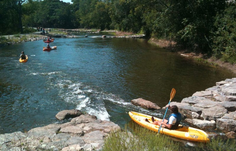
Platte River
Platte River starts from Long Lake at the lower peninsula of Michigan. It’s short, running for only 30 miles and drains into Lake Michigan, in Sleeping Bear Dunes National Lakeshore.
Platte River has 2 parts:
- upper part
- lower part
The upper part of the Platte River has better sceneries and is ideal for experienced kayakers. Although its rapids do not go above second class, the upper sections’ waters are quick, and it features sharp turns.
Should you be looking for the best place to kayak in Michigan, ideal for a paddler with any skill level, you should settle for the lower part of Platte river. Water Currents here are gentle. Turns, on the other hand, are less sharp and slower.
Kayaking at the lower Platte River exposes you to Michigan’s fish weir. The small dam operates during the salmon migration in the months of august up to October.
More info on the Platte River
Manistee River
Manistee River’s starting point is in the northern peninsula near Mancelona town.
It flows parallel with the Au Sable River for 12 miles, so it’ll give you a few hours of quality paddling. It then turns to the southeast and empties into Lake Michigan.
It is similar to the Au Sable, as it boasts picturesque sceneries, campgrounds, and varied wildlife.
You will also have to be mindful of the dams created along the kayak trail. Despite that, the Manistee River has calm water with rapids that go up to class II.
More info on the Manistee River
Two-Hearted River
The two-hearted river lies at Michigan’s Upper Peninsula. It is nearly 30 miles long and empties into Lake Superior.
While you kayak here, there is a wide range of wildlife to see, as well as plenty of beaches and beautiful scenery.
If you are looking for campsites, there are plenty along the river shore. This makes your two-hearted river trip suitable for a multi-day visit.
The Two-Hearted River features small class II rapids ideal for both experienced and also non-experienced paddlers.
More info on kayaking on the Two-Hearted River
Grand River
Grand River starts at the Northern Peninsula of Michigan, running for 60 miles to the west before emptying to lake Michigan. You can access it from 18 points on the Grand River water trail.
It is amongst Michigan’s longest rivers and really one of the best places to kayak in Michigan. Its length allows for multi-day trips.
I would not recommend heading towards the city of Grand Rapids since it has multiple lower dams and lacks scenery. Despite the name, there are no rapids in Grand Rapids.
Other zones of the Grand River have little to no civilization and feature pristine nature. Also, spots such as Lansing offer a view of Michigan town, buildings, and homes. There are also class II rapids, ideal for experienced kayakers.
More info on the Grand River water trail
Huron River
The Huron River starts from Big Lake in northwest Pontiac found in southeast Michigan. It then flows into Detroit at the South of Lake Eerie.
With a length of 130 miles, Huron River offers 104 miles of kayaking trails.
Any kayaker will find what they are looking for on the Huron River:
- If you want a relaxing trip, go to the mouth of the river.
- If you are after fun, small rapids ranging up to class II are upfront the stream.
A kayaking trip at Huron River is usually a multi-day adventure. You have multiple spots to choose from, and there are 36 access points. On the other hand, Campsites are four on the count, visible along the shoreline.
More info on the Huron River
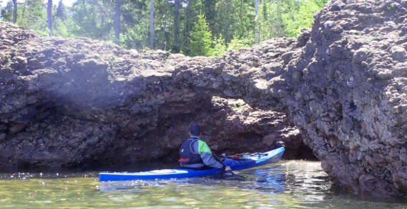
Pictured Rocks National Lakeshore
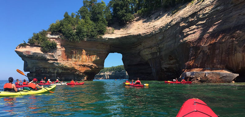
Pictured Rocks National Lakeshore lies in Michigan’s Northern Peninsula along Lake Superior. It is appealing to the eye and perfect for kayaking as well.
The Lakeshore flows for 42 miles exposing Michigan’s finest scenery with its 15 miles hugging the Lakeshore. You’ll see dazzling cliffs that form 49 to 200 feet above the lake.
Apart from the pictured rocks, the Lakeshore also boasts dunes, waterfalls, and lighthouses.
There are campgrounds along the shore in case you want to go on a multi-day kayaking trip.
Simply put, rocks national lakeshore is a spot not to miss. It is not just one of the best places to go paddling in Michigan, but one of the best places to kayak in the world.
Be mindful of weather conditions if you plan on paddling here, as it is remote and rescue can be hours away. Water conditions can change very quickly, which means you need to prepare well.
More info on Pictured Rocks National Lakeshore
Turnip Rock on Lake Huron
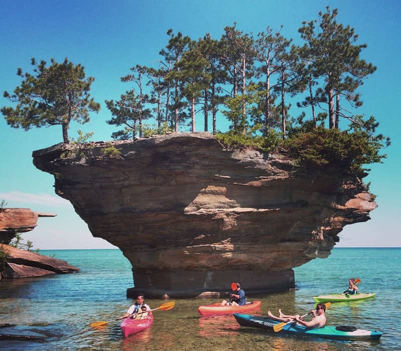
We can’t leave out one of the most remarkable landmarks in Michigan, Turnip Rock.
You will find Turnip Rock at the center of Lake Huron. And in case you never knew, it’s a symbol of a turnip growing out of the water, making it an island.
You can only get to turnip rock through water, having to paddle about 3.5 miles.
Once you are there, you will find the shallow waters worth exploring as well. Just be mindful of the rocks in the water, remove your skeg or lift your rudder.
The shore is private land, so stick to exploring the lake.
More info on lake Huron Turnip Rock
Elk Rapids
The community of Elk Rapids is on the lower path of the northern peninsula.
Lakes encircle the entire town. Traverse Bay is at its west, while Elk Lake is at its east.
The waters around it make Elk one of the best places to kayak in Michigan. You have the option to kayak in the Grand Traverse Bay, and should you intend on having a multi-day trip, you can use the Barnes campgrounds.
After that, you can head to Lake Michigan or start kayaking at Elk Lake and venture into the Chain of Lakes, a network of 4 rivers and twelve lakes.
More info on paddling in Elk Rapids
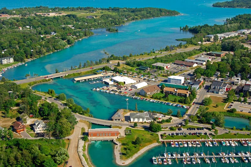
Canals of Detroit in Southeast Michigan
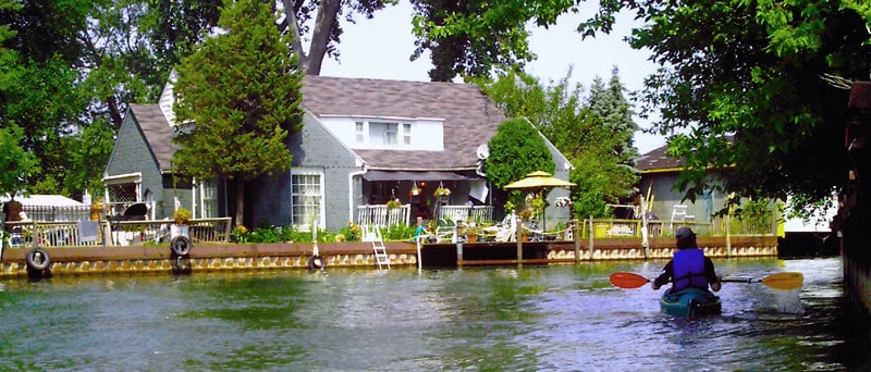
The southeast canals hug the neighborhoods of Eastern Detroit. They are among the most unique and best locations to paddle in Michigan. You will find the channels along the Detroit River near the joining point of St. Clair and Detroit.
The diverse sceneries depict the canals’ uniqueness, and it will take you up to 3 hours to explore the whole canal setting.
Before you get to the canals, you will paddle through the Detroit River with views of abandoned houses and stunning mansions along the way.
More info on the Canals of Detroit
Keweenaw Water Trail
The fun here is about exploring the rugged shores of Keweenaw. It unfolds once you follow the Keweenaw Water Trail, which can take almost seven days to explore fully.
You get views of the lighthouses, cliffs, mining ruins, and waterfalls along the way, so have your camera handy.
Also, there are wildlife varieties that you wouldn’t wish to miss.
Owing to the calm and still water setting, Keweenaw is regarded as a perfect kayaking location for paddlers of any skill level.
More info on the Keweenaw Peninsula
Inland Waterway
The historic Inland waterway runs for 38 miles. It starts at the North of Petoskey and then connects with a series of rivers and lakes and seven major Michigan Parks.
There are many things to explore on this water trail, including preserved historic communities, numerous campgrounds, day-use parks, and resorts.
The Inland Waterway is a popular motor boating destination and can become congested. You will be sharing the water with jet skis, speed boats, and water skiers.
More info on the the Inland Waterway
As you can see from the list above, Michigan is a great place to go kayaking. I wanted to cover the best places to go paddling in Michigan, but if you know of any more, please let me know in a comment below.
Also, if you have a kayaking company at these locations and would like to be featured on this page, please get in touch.